LITHOGRAPH SHOWING LAYOUT OF GOLIAD’S ‘FORT DEFIANCE’ DRAFTED IN DAYS THAT PROVED VITAL TO INDEPENDENCE
In the weeks before Texas declared its independence from Mexico, Colonel James Fannin took his men to defend Presidio La Bahía at Goliad. After the overwhelming defeat of Texas rebels at the Alamo about 100 miles away, Fannin prepared for the advancing Mexican Army by fortifying the presidio and renaming it Fort Defiance.
EVENT
AMERICANA & POLITICAL SIGNATURE® AUCTION 6235
Feb. 27-28, 2021
Dallas
Online: HA.com/6235a
INQUIRIES
Curtis Lindner
214.409.1352
CurtisL@HA.com
Enlarge
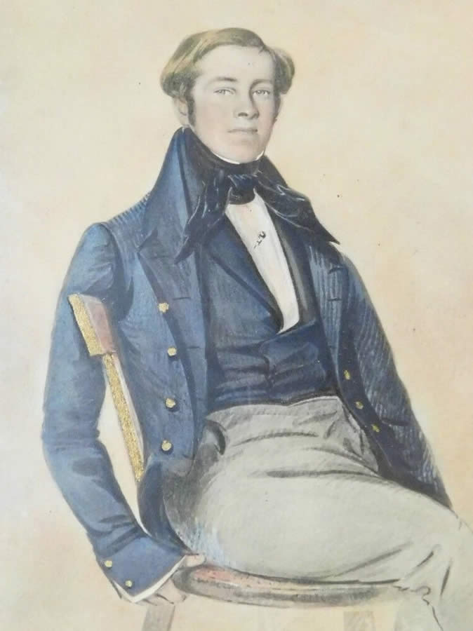
Among Fannin’s officers was Joseph M. Chadwick, 24, a military and topographical engineer from New Hampshire who had attended West Point and in 1835 volunteered to help Texas win its independence. Chadwick’s duties included mapping the presidio. Among his apparent last acts was sending the drawing, dated March 2, to his family back on the East Coast.
On March 19, Mexican troops surrounded 300 men of the Texian Army on an open prairie near Goliad. After the Mexicans received overwhelming reinforcements and heavy artillery, Fannin – faced with annihilation – raised a white flag. The rebels were returned to the presidio, now their prison, and executed as “pirates” on March 27, 1836.
The brutality of the executions was among the factors that strengthened the resolve of the rebels. Within four weeks, Mexican General Antonio López de Santa Anna was defeated at the Battle of San Jacinto, opening the path for Texas’ full independence.
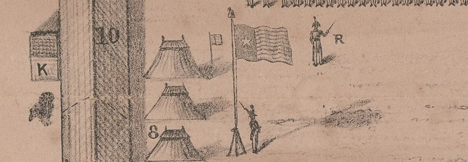
Based on Chadwick’s drawing, New York lithographer Alfred E. Baker in the weeks or months after the massacre produced a lithograph with a bird’s-eye view of the fort, showing the church within its walls and the position of the various companies. Baker’s modifications included what may be the first printed depiction of a Texas revolutionary flag. Both the original hand-drawn map and Baker’s printed version descended through the Chadwick family and were published in a 1965 American Heritage article. Prior to that publication, the map’s existence was apparently unknown to Texana scholars.
“This is one of the rarest of all Republic of Texas maps, quite likely a unique example,” says Curtis Lindner, director of Americana at Heritage Auctions. “It is quite possible that it was printed solely for the family and not for public sale. As far we can tell, this is the only-known impression of this important historical document.”
Enlarge
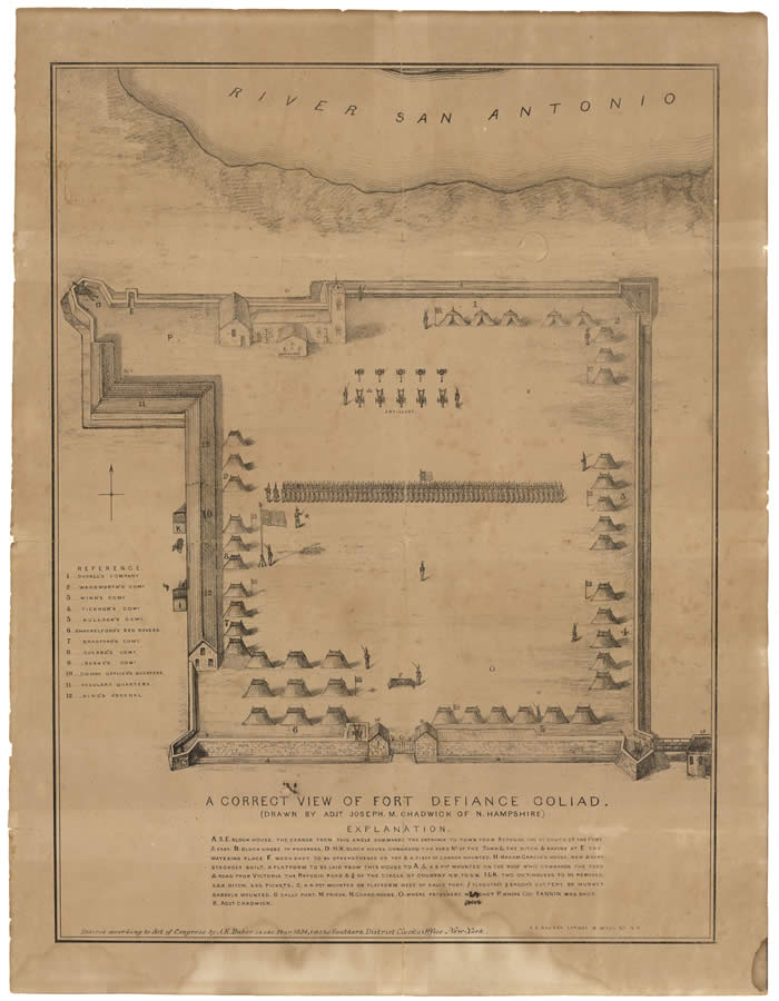
Map Showing “A Correct View of Fort Defiance Goliad”
Printed and published by A. E. Baker, 8 Wall Street, NY
Image size: 16 x 12 1/8 in.
Opening bid: $50,000
This article appears in the Winter 2020-2021 edition of The Intelligent Collector magazine. Click here to subscribe to the print edition.